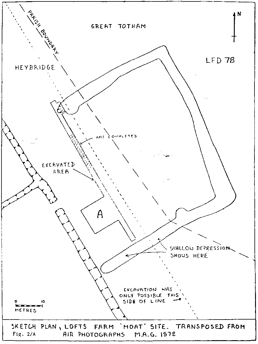
This rectangular crop mark feature was the subject of Maldon Archaeolical Group's first excavation at Lofts Farm which is described in a 1978 Interim Report.
The 1830s Heybridge tithe map shows one remaining section of the 'moat' as a narrow pond which corresponds to the visible dip noted in the excavation Interim report. The 1970s Ordanace Survey map shows the Heybridge to Great Totham parish boundary taking in and turning at this very shallow depresion. The boundary line is shown on the drawing below.
This boundary alignment, which did not follow any hedge lines, suggests to me that the moat feature had been significant in the past and was perhaps included in the Heybridge parish rather than that of Great Totham.